
Relatively dry conditions persist in Southern California; Sierra Nevada snowfall best in years
A handful of modest weather systems have brought generally light precipitation and cold temperatures to parts of California over the past week or so, mostly in the north. While these systems did little to alleviate long-term water deficits, they did preferentially add some more water to the already healthy Sierra Nevada snowpack. In fact, statewide snow water equivalent is slightly above average for this calendar date.
Long-awaited East Pacific pattern change finally at our doorstep
The large-scale atmospheric shift I’ve been referencing in nearly every blog post from the past 6 months has finally materialized. This is the classic El Niño pattern that I have discussed in previous posts, with a powerful Pacific jet aimed either directly at or south of California.
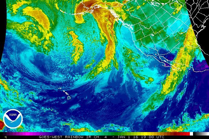
An active storm track can be seen in satellite imagery developing over the Eastern Pacific. (NOAA)
The area along of just north of the jet stream is a favorable position for storm development and intensification. Usually, California is located near the regional minimum of jet stream strength as it veers northward, but the imminent pattern shift will create a situation in which storms are much more likely to maintain their open-ocean strength or even strengthen as the approach California from the west.
California’s favorable position to the north of a very strong subtropical jet leads to large instability in model solutions due to the much faster growth rate of storm systems than would typically be the case here (and, therefore, we should all expect forecasts to bounce around quite a bit in the coming days).
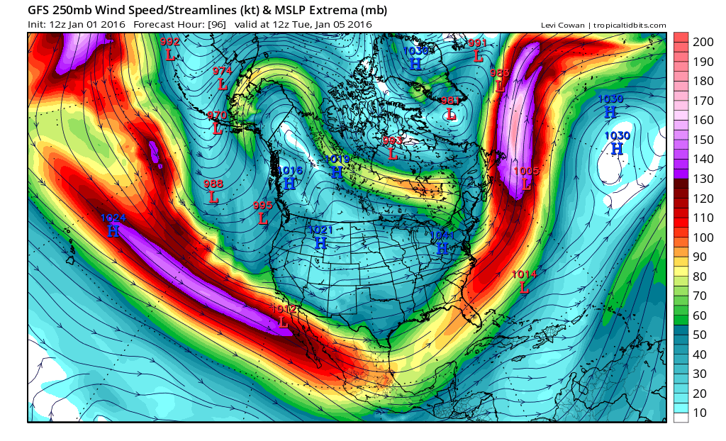
A powerful and likely El Niño-influenced subtropical jet will develop over and south of California, creating a favorable condition for significant precipitation. (NCEP via tropicaltidbits.com)
But the screaming message, at this point, is that quite a few storms will affect California over the next 2-3 weeks. It seems very likely at this point that virtually all of California will experience significant, perhaps heavy, precipitation.
And what of El Niño itself? Well, it’s still a top-tier event on par with those which occurred during 1982-1983 and 1997-1998. It is quite clear that a powerful El Niño influence will remain in place for the rest of California’s rainy season.
California’s drought condition and its impact on the California Almond crop is an important topic for our readers. Blue Diamond would like to thank Mr. Swain for allowing us to post excerpts of his articles on our website. To view the article in its entirety click here.
© 2015 WEATHER WEST